blah blah blah
Mt. Hancock
Length: 9.8 miles out-and-back with loopDifficulty (click for info): Extreme
Elevation Gain: 2700 feet
Rating (click for info): 7/10
Elevation: 4420'
Prominence: 1240'
Driving Directions:
Trailhead and parking area are on the Kancamagus Highway in Lincoln, NH. Park at the Hancock Overlook, which is 12.7 miles east of Rt. 93 in Lincoln (at Exit 32) and 24.5 miles west of Rt. 113 in Conway. The Hancock Overlook is a large parking area with a viewing area just east of the hairpin turn.
About the Hike:
The Hancocks, located in the geographical center of the White Mountains, are usually only ascended by those hikers bound for the 4000-footers. Their views are very nice, but it is easy to find a more accessible mountain with a much better view. Climbing the Hancocks involves a long walk through the forest and a brutal 0.7-mile climb over extremely steep and rough terrain. Inexperienced hikers will likely not find the rough trip to these two peaks worthwhile, but devoted mountain-lovers can derive much joy from the scenic brook walks and fine views.
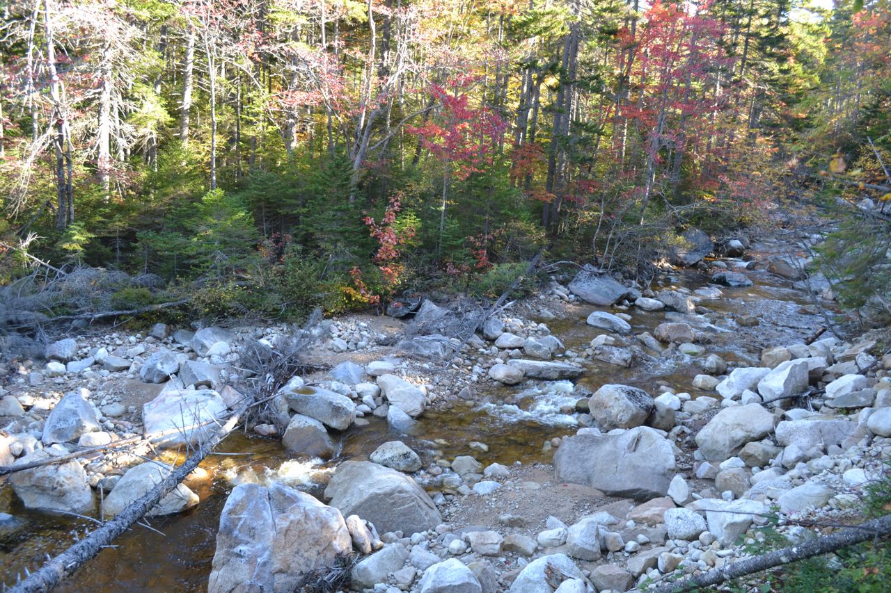
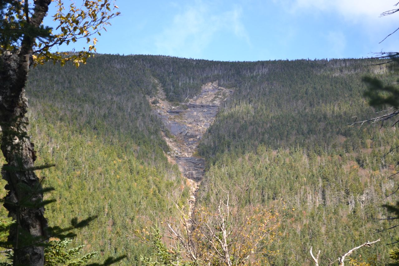
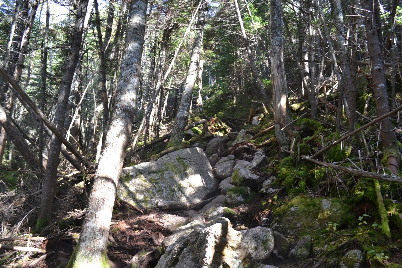
The hike starts at Hancock Overlook, a viewpoint looking up to the Osceolas and Scar Ridge on the Kancamagus Highway. From the north end of the parking area, walk through the push gates and follow the path down to the hairpin turn on the highway. Cross the road to the trailhead for the Hancock Notch Trail. The trail descends from the highway, then follows the fairly flat route of an old logging railroad across the lower slopes of Mt. Huntington. After a little more than half a mile, the trail dips to cross a brook, then continues to climb gradually uphill. The trail eventually meets up with a much larger brook, the North Fork of the Hancock Branch of the Pemigewasset River. In 1.2 total miles, it passes a scenic viewpoint over the North Fork. The trail soon turns away from the river and crosses three smaller brooks in quick succession. In half a mile, turn left onto Cedar Brook Trail, where the pathway becomes slightly steeper. The trail then returns to the river at a point where it formerly crossed. Fortunately, the trail has been recently relocated to avoid four unnecessary and difficult crossings on the old route. It now zigzags over a few small hills away from the river, then descends back to it. At this point, the trail crosses the river, then reaches the junction with the Hancock Loop Trail. Turn right and cross the North Fork again. The trail then begins to climb. After the ascent becomes moderately steep, the trail crosses a small brook at a section of small cascades. It continues to climb moderately for under a mile to the loop junction. From this area, you can look through the trees to see the Arrow Slide on the side of Mt. Hancock. Turn left onto the north branch of the loop, which descends steeply to a final brook crossing, then quickly begins an extremely steep ascent up the side of the mountain parallel to the slide. Rock staircases aid your ascent near the bottom, but the surface becomes gravelly higher up. As you climb, you will be able to glimpse views to the Sandwich Range and South Hancock. The trail moderates near the top, passes by a few limited viewpoints, then reaches the summit, marked by a trail junction, after 0.6 miles of climbing. You have now entered the Pemigewasset Wilderness. Turn left and descend to a ledge to see the view.
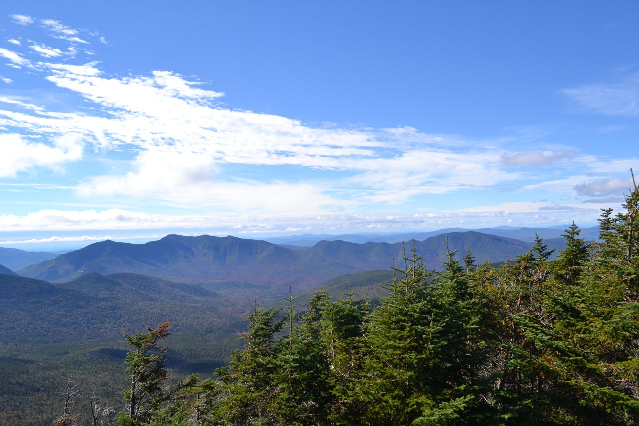
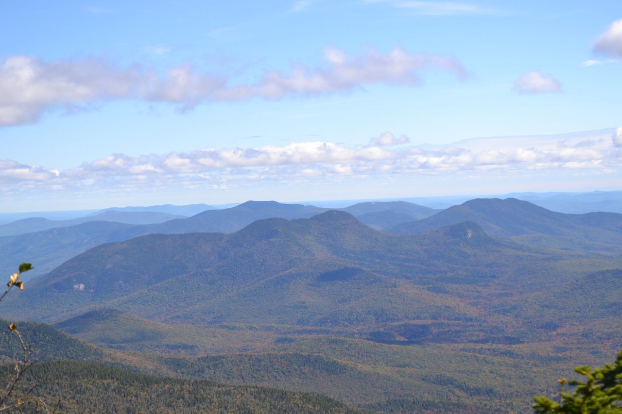
The viewpoint ledge yields a wonderful view of the Sandwich Range and the Osceolas. To the far left, seen over Middle Hancock, is Mt. Chocorua. Over South Hancock are Mts. Whiteface and Passaconaway and the Tripyramids. Further over is Sandwich Dome, with Mt. Kancamagus below it, and Mt. Huntington below that. Across Mad River Notch from Mt. Kancamagus are the four peaks of Mt. Osceola, followed by the bumpy Scar Ridge. When you've finished admiring the view, the "Ridge Link" of the Hancock Loop Trail will take you to South Hancock. Return to the junction and continue on the trail. It descends easily from Mt. Hancock through spruce woods with occasional glimpses north through the trees. It then steepens and quickly reaches another flat area on the ridge. The trail climbs over a small knob, then climbs gradually to the wide summit of Middle Hancock, reached in 0.9 miles from the main summit. A quick descent brings you to a small boggy area. The climb to South Hancock is short (0.4 miles) and easy. About halfway, a trailside rock offers a limited view to the Franconia Ridge. The summit of South Hancock is wooded, but another near-summit ledge, reached via a short spur on the left, reveals a view to the southeast, toward the Moat Range.
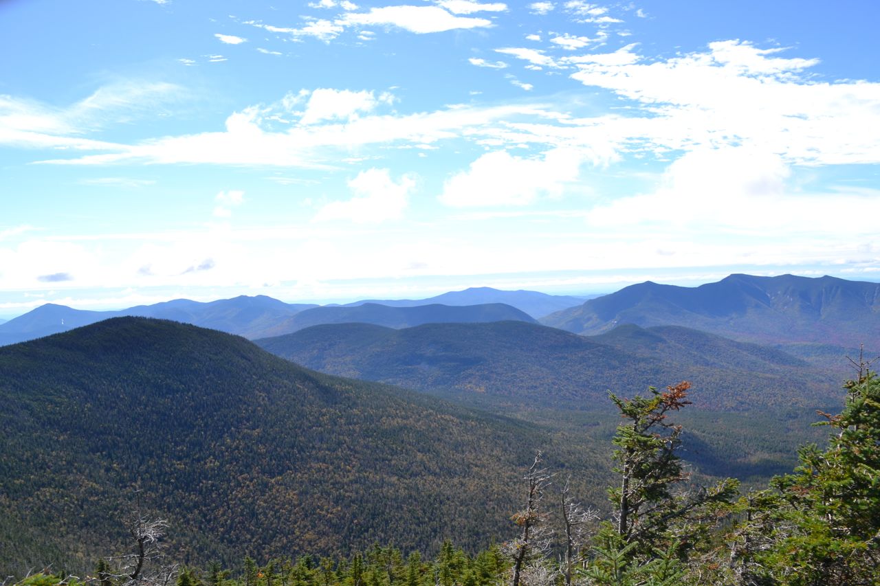
Through the trees to the left, you can see towering Mt. Carrigain, with its summit observation platform. In the distance, you can see Kearsarge North. Closer and to the south, you can see the ski trails of Little Atitash Mountain, with Big Attitash and North Moat Mountain above. In the foreground is the double-peaked Mt. Tremont, with its sharp Owl's Cliff below. Behind Owl's Cliff is Bear Mountain. Further to the south and even closer is the small Green's Cliff; in the distance is Mt. Chocorua. A few more of the Sandwich Range peaks can be seen through the trees to the right. When you've had enough of this view, descending the very steep south branch of Hancock Loop for half a mile will bring you back to the loop junction. At points along the trail, you can look through the trees to the Franconia Ridge, Owl's Head Mountain, and Mt. Garfield.
Printable directions page